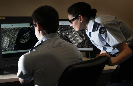
The increased availability of information collected by space based sensors is changing our battlespace by creating new threats and opportunities. Recent advancements in commercial satellite technology have resulted in widespread public access to information that was previously only obtainable through classified intelligence programs. This post examines some of the recent trends and capabilities of commercial satellite systems and their use to inform future Army thinking.
That a picture paints a thousand words makes the use of satellite imagery a compelling and apparently irrefutable source to back up claims or expose the actions of other parties in an information battle. Various state and non state actors involved in conflicts are using a combination of official information releases, quasi-independent NGOs and a variety of media organisations to release ‘proof’ in support of their various narratives.
In the past, Governments have occasionally released imagery to convince their populations of the need for action; an infamous example being the aerial reconnaissance photos from the Cuban missile crisis of 1962. Such actions were generally rare due to the need to safeguard the capabilities and limitations of the collection assets used to obtain them, but commercial imagery has no such restrictions. Steady progress has seen the spatial resolution of commercial platforms drop below previous United States (US) government imposed restrictions, with resolutions of 0.25m now possible. Such imagery answers the majority of military and government intelligence requirements, and makes open source intelligence analysis much more powerful than before.
Powerful systems like space based commercial Infra Red and Radar sensors have the potential to cover very large areas and easily detect and track naval vessels on the open seas or the signature of a combat brigade headquarters in near real time. While the US government has the capacity to embargo data release from US owned systems during conflict, no such restrictions apply to the satellites of other countries. The cost of access to this information is insignificant, and linking it to appropriate weapons systems creates a very real threat.
Many of these satellites can effectively be seen as dual civilian-military use capabilities, particularly given the military sponsorship of their operations, and are operated by a number of countries. The increased availability of this information has also seen a proliferation of Non Government Organisations (NGOs) entering the information battle in areas that were previously the domain of military intelligence. While there are still barriers to access (including the expense of images and the knowledge about where and when to look for), the multitude of commercial platforms mean this use will only increase. These effects – the availability of imagery and the public analysis of it – will certainly influence Australian Defence Force (ADF) operations in any future mid or high intensity conflict.
Today, governments are increasingly using commercial imagery to support their strategic narratives. The North Atlantic Treaty Organisation released commercial imagery in 2014 to provide evidence for its claims of Russian interference in the Ukraine. On the other side the Russian Ministry of Defence released images purporting to show Ukrainian involvement in the downing of flight MH17; that they were quickly derided as fakes by some is further evidence of the information battle that accompanies such ‘authoritative’ evidence. However, governmental release is not the only technique to shape the “narrative”.
The trend of using NGOs to release information simultaneously distances authorities from diplomatic considerations while increasing the apparent independence and veracity of the information. Such techniques are widespread in the battle of ideas that has accompanied recent conflict in the Ukraine, international intervention in Syria, and the ongoing tensions in the South China Sea. For example, the release of images of widespread land reclamation in the South China Sea by a government would be viewed as an official act to exert diplomatic pressure (and might be deemed propaganda by the target audience). In comparison the release of the same images by an independent company produces the same information operations effect (with an arguably greater perception of authenticity) without necessarily generating the corresponding disapproval from the opposition. There are a number of different organisations that fill this intermediary role, from commercial organisations to academic institutions and independent media.
The information and intelligence derived from space based sensors is no longer just for use by military commanders and intelligence personnel. Future conflicts will see commercially sourced information in widespread use for reconnaissance, kinetic targeting and to influence populations. We should be aware, and prepared.


